

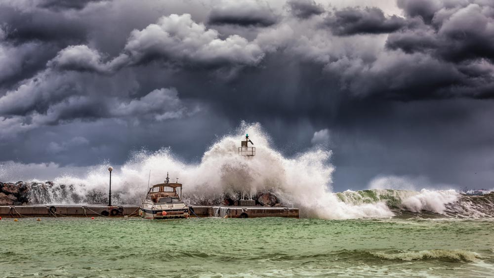
From rising sea levels to increased storm activity and flooding, Europe’s coastal regions are particularly exposed to global climate risk. In this interview, Elco Koks of Vrije Universiteit Amsterdam’s Institute for Environmental Studies talks us through how RECEIPT is working to quantify these risks and help infrastructure planners manage future uncertainties.
What exactly does the term ‘coastal infrastructure’ cover in the context of RECEIPT’s research?
We are looking at infrastructure along the coastline: so basically any structures or systems providing a basic service such as electricity, water supply, waste, transportation. What we don’t include are physical barriers such as dykes built on the shoreline – we would view these rather as a means of protecting the infrastructure that lies beyond.
And why focus on infrastructure along the coast in particular?
The main reason for looking at coastal infrastructure is the projections around extreme sea level rise, especially in places like the Netherlands or the UK where the more extreme scenarios could be quite catastrophic. What’s interesting about zooming in on infrastructure is that it’s planned and built for the long run. You don’t build a power plant with a lifespan of 20 years, you build it to last 100 years; so you really need to look far ahead in the future. And particularly when it comes to sea level rise, there is so much uncertainty around these potential futures – yet coastal areas are super densely populated and often where much of a country’s economic activity is located, such as in port areas.
What sort of impacts would remote climate effects have on this infrastructure?
Looking at it through the lens of trade relations and supply chains, you could imagine the effect of a hurricane arising in the Atlantic that hits the US east coast. Even though this is not happening in Europe, we will still feel its impact on the activity in our ports because of our reliance on goods coming from the US. Take Rotterdam and Houston – two of the biggest petrochemical ports in the world: if Houston is in future affected by hurricanes more severely or more often, the impact is bound to reverberate to Rotterdam too.
We also see cases where coastal infrastructure is already prone to erosion and flooding caused by rising sea levels. One well-known example is the railway line in Dawlish in Cornwall in the south of England: the line was being flushed away by flooding, leaving large parts of Southwest England inaccessible by train.
Which stakeholders do you imagine would be most interested in RECEIPT’s findings on coastal infrastructure?
Primarily it’s the infrastructure planners and providers themselves and national governments who have to make these long-term planning decisions and need guidance to narrow down, quantify or understand the future uncertainties ahead. The storylines we will develop in RECEIPT can help these groups grapple with potential future impacts without needing to engage in traditional in-depth probabilistic analysis.
How much attention do infrastructure planners already pay to climate change in their daily work?
Taking the Netherlands as an example, for a long time infrastructure providers simply assumed that the dykes protecting the coastline will hold, no question – so there was no need to think about adaptation or future climate risks. But as it becomes clear that this is not necessarily the case, they have started thinking more about how to deal with these future climate change effects. However, they struggle with knowing what scenario to use, what uncertainties to take into account, how to quantify these and what it means for their investment. RECEIPT can help them answer those questions.
Have you already identified some global hotspots where the impact of climate change is particularly relevant for Europe’s coastal infrastructure?
We have a few particularly interesting candidates. One is the potential growth in intensity of hurricane activity in the Atlantic and the impacts on the East Coast US, as I mentioned. Two others relate to how rising temperatures can cause ice to thaw: first, the melting of the West Antarctica ice sheet, which can cause a really high increase in global sea levels impacting Europe over the long term; and second, the Arctic region, where melting sea ice may even open new trade routes that could alter where investments are made in new ports.
Melting ice opening up new trade routes – that almost sounds like a positive effect?
Well the impacts on the ecosystem and the natural environment on the whole are of course extremely detrimental. But sometimes climate change causes positive effects for a particular locality. Similarly in a sector like agriculture, climate change might mean a certain region can’t grow cacao anymore, but another can grow it more easily. We shouldn’t ignore these effects, even if the overwhelming majority of impacts are highly negative.
Which partners are you working with on RECEIPT’s coastal infrastructure research and how do you work together?
What’s nice about the project is that it brings together a diverse group in terms of research backgrounds: from climate scientists to economists, financial specialists, social scientists and people working on the ground in social partner organisations… this is the kind of collaboration that creates new and innovative results as you reach across boundaries and are forced to think outside of your comfort zone. On the coastal infrastructure side, our IVM team is working with Dutch meteorological institute KNMI on the climate modelling, Paul Sayers on flood and erosion management, and FEEM on Arctic trade routes and coastal flood modelling.
What is the main goal you hope to achieve with RECEIPT by the end of the project?
We really hope we can provide guidance to infrastructure planners in tackling climate uncertainties and make the future a bit more approachable. If we can make it even slightly easier for a planner to make a decision by helping them understand the potential future impacts, then I think we will have been successful.
Get more information about our storyline research on coastal infrastructure here.
Elco Koks is Assistant Professor at the Institute for Environmental Studies of the Vrije Universiteit Amsterdam. Working within the Water and Climate Risk group, his research focuses on flood risk, disaster impact modelling, critical infrastructure and extreme weather. He specialises in modelling economy-wide consequences of disasters on both a regional and interregional level, focusing on industrial impacts and infrastructure systems.
Published on : 24 August 2020